Design Alternatives Phase Summary
Thank you to all who participated in the Open House + Listening Session, Pop-Up Event, Merchants' Round Table and provided feedback through the survey during the Design Alternatives Phase for the new park at Linden and Pine. A summary of these engagement activities and feedback gathered is available below. The next phase of engagement and design will kick off in early 2025.
Design Alternatives Summary(PDF, 8MB)
City Council Project Update - 10/23/24
At the October 23rd SSF City Council meeting, City staff and the design team presented an update on the community engagement and design process so far for the new park at Linden and Pine Avenues. The slideshow began with background on the project, including development decisions and environmental cleanup. Next, the project team shared an overview of community design events, the emerging vision and priorities, and the initial feedback on two alternative designs that were shared with the community in August and September. Several citizens voiced questions related to soil remediation and traffic, while others voiced supportive comments and excitement about the coming park. City staff and the design consultants answered Councilmembers' questions, and the Council expressed support to move on to the next phase of the project--moving towards a final, preferred concept to implement.
Watch the Council Meeting Project Update Video
Instructions to turn on captions on YouTube:
- Tap the cog icon (the settings menu)
- Tap Subtitles/CC (1)
- Tap English (auto-generated)
- Tap Subtitles/CC (1) again
- Tap Auto-translate
- Scroll down to your preferred language
Morelos Hall - 9/29/24
On Sunday, September 29th, a representative from the design team presented the park concepts of the Sociedad Mutualista Mexicana de Morelos, also known as Morelos Hall. The meeting was a regular monthly meeting and approximately 25 people attended. The presenter informed visitors in Spanish about the two alternative park concepts and described the differences between each design. Participants asked questions about each concept and offered suggestions on how to adjust the designs. Participants were also encouraged to fill out a survey after the event.
Centennial Way Park South Grand Opening - 9/29/24
On Sunday, September 29th, South San Francisco staff and the design team attended the Centennial Way Park South Grand Opening from 10 am-12 pm. Approximately 20 people visited the tent. The design team informed participants about the two alternative park concepts, answered questions, recorded comments, and shared the online survey with passersby. Several informed participants took the survey on their mobile devices and the provided iPads.


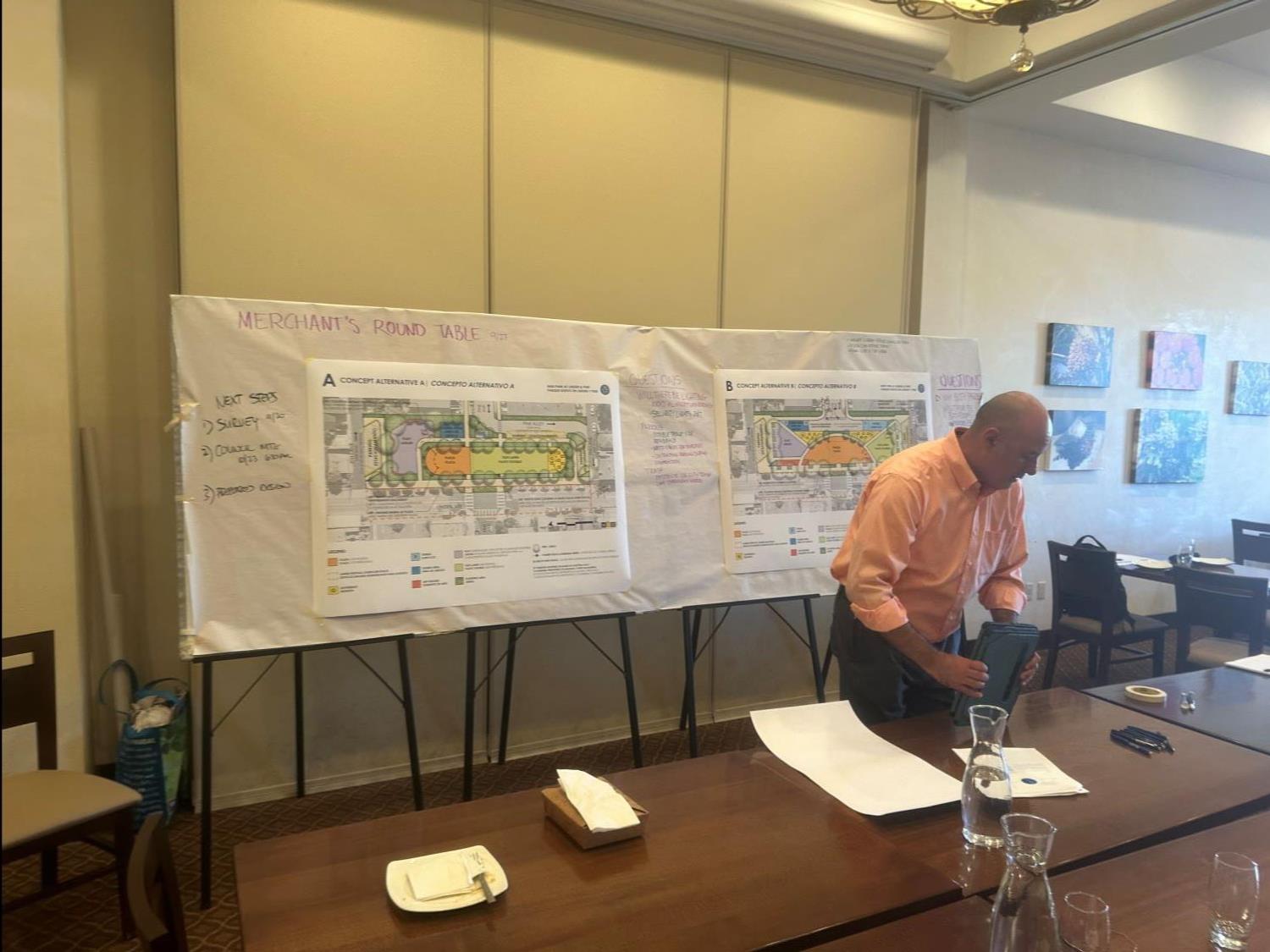
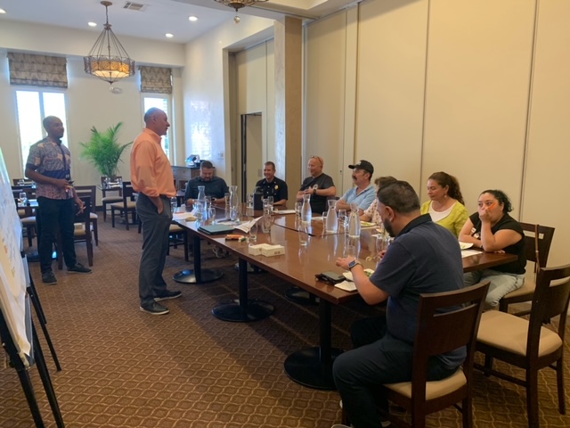
Merchants' Round Table - 9/27/24
On Friday, September 27th, South San Francisco staff, including the Fire Marshal, and the design team hosted a second Merchants’ Round Table event. Five local business owners attended the event held in Amoura’s restaurant across the street from the park area. The participating business owners sat down with City Staff and the design team to discuss concerns, including traffic circulation, emergency access, and parking strategies.

Concert in the Park - 9/21/24
On Saturday, September 21, South San Francisco staff and the design team attended the Concert at the Park at Orange Memorial Park from 11 am-3 pm. Approximately 40 people visited the tent. The design team provided an overview of the two alternative park concepts, answered questions, recorded comments, and provided the online survey to interested participants. The bilingual survey was provided to participants on iPads or paper. Staff also handed out South San Francisco Parks and Recreation refrigerator magnets to attendees.


South San Francisco Youth Commission - 9/9/24
On Monday, September 9, South San Francisco staff presented an update of the park project to the Youth Commission. Printed copies of the survey and links to the online survey were provided to the Commission.
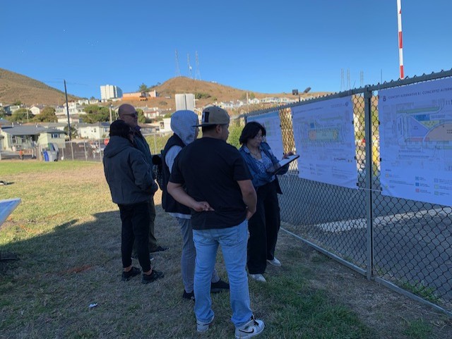
Open House Event 2 - 8/24/24
On Saturday, August 24th, South San Francisco staff and the design team hosted an Open House from 9:00 am - 1:00 pm at the future park site (700 Linden Ave). Approximately 60 people visited the event tents, where staff gave an overview of the concepts, answered questions, and recorded comments. Participants were also encouraged to take a bilingual online survey either on their own phones or on the ipads provided with staff assistance.


Movie in the Park - Pop-Up Event - 8/16/24
On Friday, August 16th, City staff and the design team hosted a Pop-Up station at South San Francisco's Movie Night in the Park, held at Martin Elementary School from 6:00 p.m. – 8:00 p.m. About 25 people evaluated the two design concepts, providing valuable feedback to help guide the final design.


National Night Out Tabling Event - 8/6/24
On Tuesday, August 6th, South San Francisco staff and the design team hosted a table at National Night Out at the Paradise Valley Recreation Center. About 20 participants stopped by to review community input from the project's Visioning Phase and learn about upcoming public events to weigh in on two design alternatives. Firefighters, police officers, and waste management staff were among the attendees, and shared their ideas on several possible street configurations.


Visioning Phase Summary - 7/24/24
Thank you to all who participated in the Open House + Listening Session, Pop-Up Event, Merchants' Round Table and provided feedback during the Visioning Phase for the new park at Linden and Pine. A summary of these engagement activities and feedback gathered is available below. The next phase of engagement and design will kick off in early August and run through September.
Visioning Phase Summary(PDF, 6MB)
Merchants' Round Table - 5/30/24
May 30th, 2024, Thursday | 2:00 – 3:00pm | Amoura Restaurant, 713 Linden Ave., SSF
City staff and the design team held a focus group session with the neighboring business owners at Amoura’s restaurant, across the street from the new park. The discussion centered on business-specific topics such as parking, loading, safety, activation and customer experience. The group also looked at examples showing how other parks have supported surrounding businesses, including drawing in more daily customers and providing outdoor seating options. The design team will integrate what was learned into the upcoming park concepts to create a win-win for both neighbors and businesses.

Visioning Pop-Up - 5/1/24
Visioning Pop-Up | 700 Linden Ave | Wednesday, May 1, 2024
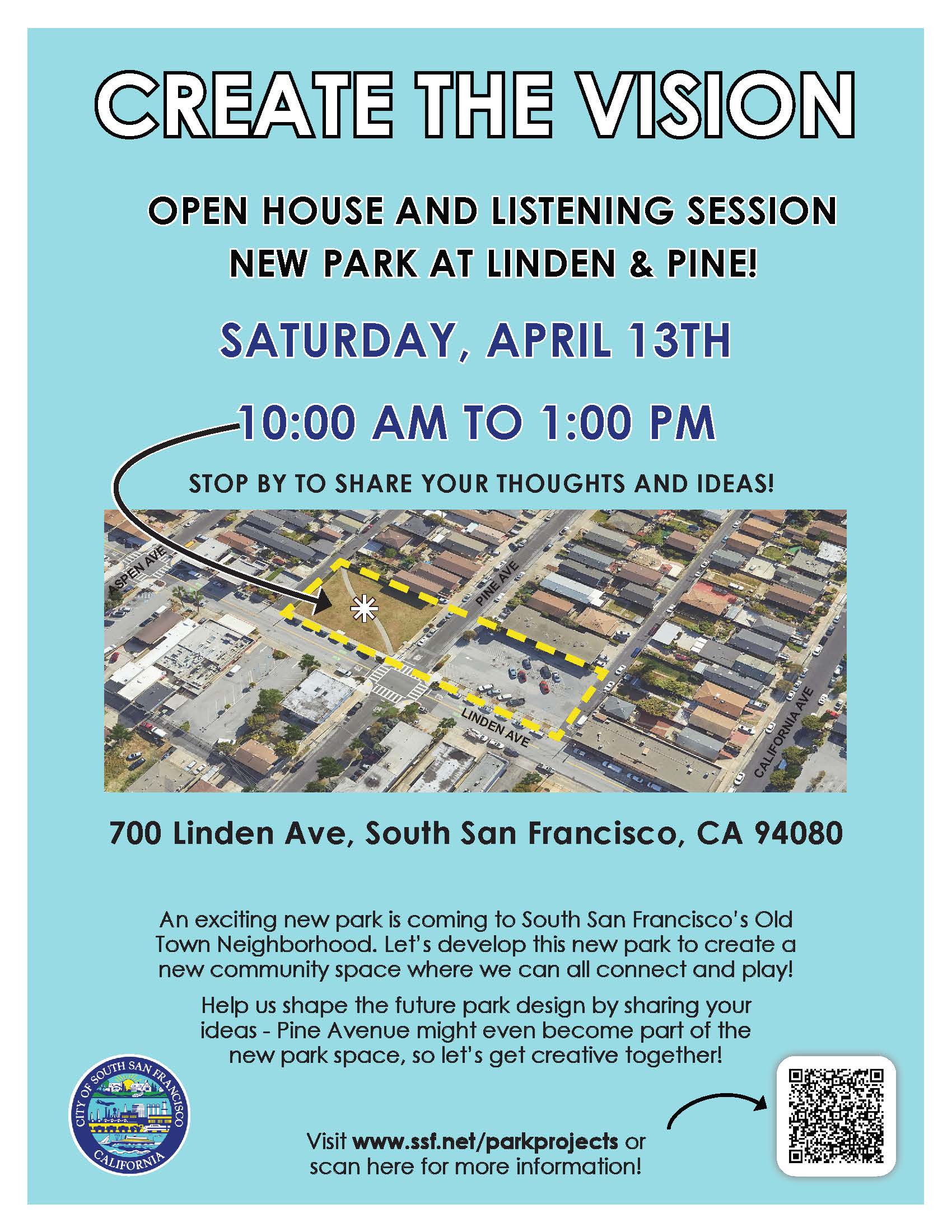
On Saturday, April 13, 2024, the City of South San Francisco sponsored an Open House & Listening Session to create the vision for a new park at the intersection of Linden Ave. and Pine Ave. The event was held in the parking lot at 616 Linden Ave., from 10 a.m. to 1 p.m. Participants had the opportunity to describe their current and past activities at the site and comment on potential preferences for the new park. Along with speaking directly with City and design representatives, participants used various methods to share their ideas and priorities. Preliminary results show a preference for community gathering and play spaces.
Missed it? Join us at the next public Visioning Event - Wednesday, May 1st from 4 p.m. to 7 p.m. - at the new park location, 700 Linden Ave.
Next Steps: After the public Visioning events, several design alternatives will be developed and shared with the public for additional input in June and July. Your feedback will help guide the final concept plan for the new park. Sign up to receive project updates to be notified of the next events for input.
Open House - 4/13/24